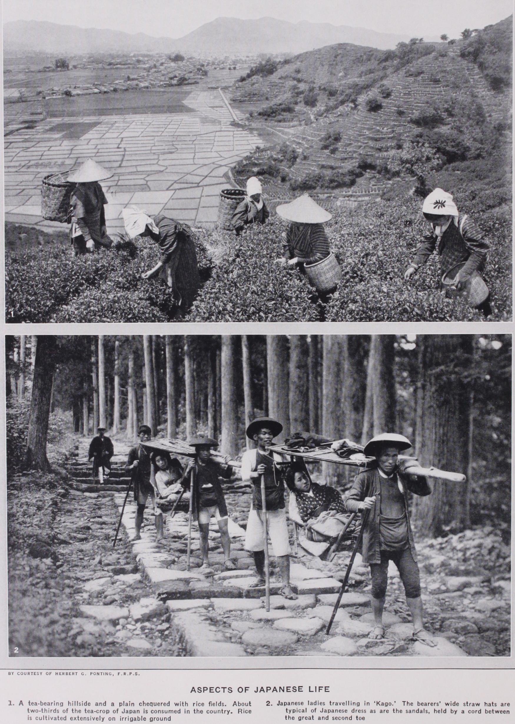
Japan
JAPAN, an empire of Eastern Asia, and one of the great powers of the world. The following article is divided for con venience into Sections as under: GEOGRAPHY ; GEOLOGY ; CLI Position and continent of Asia stretches two arms into the Pacific Ocean, Kamstchatka in the north and Ma lacca in the south, between which lies a long cluster of islands constituting the Japanese empire, which covers 37° 14' of longi tude and 29° of latitude. On the extreme north are the Kuriles (called by the Japanese Chishima, or the "myriad isles"), which extend to 156° 32' E. and to 5o° 56' N. ; qn the extreme south is Formosa (called by the Japanese Taiwan), which extends to 119° 18' E., and to 2 I° 45' N. There are six large islands, namely Sakhalin (called by the Japanese Karafuto) ; Yezo or Ezo (which, with the Kuriles, is designated Hokkaido, or the north-sea dis trict) ; HonshU or Hondo, the main island; Shikoku (the "four provinces"), Kyushu (the "nine provinces") and Formosa, the most southerly link of the chain. Formosa and the Pescadores were ceded to Japan by China after the war of 1894-1895, and the southern half of Sakhalin—the part south of 50° N.—was added to Japan by cession from Russia in 19o5.
Area.—The following table, compiled from the "Résumé Sta tistique de l'Empire du Japon" for the year 1928, shows the area of the various parts of the Empire:— This table does not include islands having a coast-line of less than 2.4 miles, unless they are inhabited or serve as guides to navigation.
The coast-line is very long in proportion to the area, the ratio being 1 m. of coast to every 9.5 m. of area. The Pacific Ocean, which washes the eastern shores, moulds their outline into much greater diversity than does the Sea of Japan which washes the western shores. Thus the Pacific sea-board measures 10,562 m. against 2,887 m. for that of the Japan sea. In depth of water, too, the advantage is on the Pacific side. There the bottom slopes very abruptly, descending precipitously at a point not far from the north-east coast of the main island, where soundings have shown 4,655 fathoms. This, one of the very deepest sea-beds, is called the Tuscarora Deep, after the name of the United States' man-of-war which made the survey. The configuration seems to point to a colossal crater under the ocean, and many of the earth quakes which visit Japan appear to have their origin in this sub marine region. On the other hand, the average depth of the Japan sea is only 1,200 fathoms, and its maximum depth is 3,200. The east coast, from Cape Shiriya (Shiriyazaki) in the north to Cape Inuboye (Inuboesaki) near Tokyo Bay, though abounding in small indentations, has only three large bays, those of Sendai, Matsushima and Yamada; but southward from Tokyo Bay to Cape Satta (Satanomisaki) in Kyushu there are many capacious inlets which offer excellent anchorage, as the Gulf of Sagami (Sagaminada), the Bays of Suruga (Surugawan), Ise (Isenumi) and Osaka, the Kii Channel, the Gulf of Tosa (To sonada), etc. Opening into both the Pacific and the Sea of Japan and separating Shikoku and Kyushu from the main island as well as from each other, is the celebrated Inland sea, one of the most picturesque sheets of water in the world. There are four narrow avenues connecting this remarkable body of water with the Pacific and the Japan sea, the Shimonoseki strait, the Hayamoto Strait and the Yura and Naruto Straits. It need scarcely be said that these restricted approaches give little access to the storms which disturb the seas outside. The western side of the island of Kyushu is more indented than any other part of the coast of Japan. Between the coast of Kyushu and the south ern extremity of the Korean peninsula are situated the islands of Iki and Tsushima, the latter being only 3o m. distant from the peninsula. Passing farther north, the shoreline of the main island along the Japan Sea is found to be comparatively straight and monotonous, there being only one noteworthy indentation, that of Wakasa-wan, and one considerable projection, the Noto peninsula. From the harbour of Tsuruga, or Wakasa bay, to Osaka Japan's waist measures only 77 m. Yezo is not rich in anchorages. Uchiura (Volcano Bay), Nemuro (Walfisch) Bay and Ishikari Bay are the only remarkable inlets. As for Formosa, the peculiarity of its outline is that the eastern coast falls pre cipitously into deep water, while the western slopes slowly to shelving bottoms and shoals. The Pescadores islands afford the best anchorage in this part of Japan.
Mountains.
The Japanese islands are traversed from north to south by a range of mountains which sends out various lateral branches. Lofty summits are separated by comparatively low , passes, which lie at the level of crystalline rocks and schists con stituting the original uplands upon which the summits have been piled by volcanic action. The scenery among the mountains except perhaps in some parts of Hida and Shinsha, is generally soft. Climatic agencies have smoothed and modified everything rugged or abrupt, until an impression of gentle undulation rather than of grandeur is suggested. Nowhere is the region of eternal snow reached, and masses of foliage enhance the gentle aspect of the scenery and glorify it in autumn with tints of striking brilliancy. Mountain alternates with valley, so that not more than one-eighth of the country's entire area is cultivable.
The king of Japanese mountains is Fuji
yama or Fuji-san, of which the highest point (Ken-ga-mine) is 12,395 ft. above sea-level. Great streams of lava flowed from the crater in ancient times. The course of one is still visible to a distance of 15 m. from the summit, but the rest are covered, for the most part, with deep de posits of ashes and scoriae. On the south Fuji slopes unbroken to the sea, but on the other three sides the plain from which it rises is surrounded by mountains, among which, on the north and west, a series of picturesque lakes has been formed in con sequence of the rivers having been dammed by ashes ejected from Fuji's crater. To a height of some 1,500 ft. the slopes of the mountain are cultivated; a grassy moorland stretches up the next 2,500 ft.; then follows a forest, the upper edge of which climbs to an altitude of nearly 8,000 ft., and finally there is a wide area of ashes and scoriae. There is entire absence of the Alpine plants found abundantly on the summits of other high mountains in Japan, a fact due, doubtless, to the compara tively recent activity of the volcano. The ascent of Fuji presents no difficulties. A traveller can reach the usual point of departure, Gotemba, by rail from Yokohama, and thence the ascent and descent may be made in one day by a pedestrian.
The Japanese Alps.—The provinces of Hida and Etchfi are bounded on the east by a chain of mountains including, or having in their immediate vicinity, the highest peaks in Japan after Fuji. Six of these summits rise to a height of 9,00o ft. or upwards, and constitute the most imposing assemblage of mountains in the coun try. The ridge runs due north and south through 6o to 7o m., and has a width of 5 to 10 m. It is mostly of granite, only two of the mountains—Norikura and Tateyama—showing clear traces of volcanic origin. Its lower flanks are clothed with forests of beech, conifers and oak. Farther south, in the same range, stands Ontake (10,45o ft.), the second highest mountain in Japan proper (as distinguished from Formosa) ; and other remarkable though not so lofty peaks mark the same regions. This group of mountains has been well called the "Alps of Japan," and a good account of them may be found in The Japanese Alps (1896) by the Rev. W. Weston.
Almost equally picturesque, though less lofty than the Alps of Japan, are the Nikko mountains. The highest of these are Shirane-san ft.), Nantai-san (8,169 ft.), Nyoho-zan (8,100 ft.), and Omanago (7,546 ft.). They are clothed with magnificent vegetation, and everywhere they echo the voices of waterfalls and rivulets.
Mountains of North and Central Japan.
In the north of the main island there are no peaks of remarkable height. The best known are Chokai-zan, a volcano 7,077 ft. high, which was active as late as 1861; Ganju-san (6,791 ft.), Iwaki-san (5,23o ft.) and the twin mountains Gassan (6,447 ft.) and Haguro-san (5,600 ft.). A little farther south, enclosing the fertile plain of Aizu, several important peaks are found, among them being Iide san (6,332 ft.) ; Azuma-yama (7733 ft.), which, after a long interval of quiescence, has given many evidences of volcanic activity during recent years; Nasu-dake (6,296 ft.), an active volcano; and Bandai-san (6,037 ft.). A terrible interest attaches to the last-nalned mountain, for, after having remained quiet so long as to lull the inhabitants of the neighbouring district into complete security, it suddenly burst into fierce activity on the 15th of July 1888, discharging a vast avalanche of earth and rock, which dashed down its slopes like an inundation, burying four hamlets, partially destroying seven villages, killing 461 people and devastating an area of 27 square miles.
In the province of Kotsuke, which belongs to the central part of the main island, the noteworthy mountains are Asama-yama (8,136 ft.), one of the best known and most violently active volcanoes of Japan; Akagi-san, a circular range of peaks surround ing the basin of an old crater and rising to a height of 6,210 ft.; the Haruna group, celebrated for scenic beauties; and Myogi san, a cluster of pinnacles which, though not rising higher than 3,880 ft., offer scenery reminiscent of the classical landscape paint ings (bunjingwa) of China and Japan. Farther south, in the province of Kai (KoshU), and separating two great rivers, the Fuji-kawa and the Tenryu-gawa, there lies a range of hills with peaks second only to those of the Japanese Alps spoken of above. The principal elevations in this range are Shiranesan-with three summits, Nodori (9,97o ft.), Ai-no-take (10,20o ft.) and Kaigane (10,33o ft.)-and Hoozan (955o ft.). It will be observed that all the highest mountains of Japan form a species of belt across the widest part of the main island, beginning on the west with the Alps of Etchu, Hida and Shinano, and ending on the east with Fuji-yama. In all the regions of the main island southward of this belt the only mountains of conspicuous altitude are Omine (6,169 ft.) and Odai-ga-hara (5,54o ft.) in Yamato and Daisen or Oyama (5,951 ft.) in HAL The island of Shikoku has no mountains of notable magnitude. The highest is Ishizuchi-zan (7,727 ft.), but there are several peaks varying from 3,00o to 6,000 ft.
Kyushu, though abounding in mountain chains, independent or connected, is not remarkable for lofty peaks. In the neighbour hood of Nagasaki, over the celebrated solfataras of Unzen-take (called also Onsen) stands an extinct volcano, whose summit, Fugen-dake, is 4,865 ft. high. More notable is Aso-take, some 20 m. from Kumamoto ; for, though the highest of its five peaks has an altitude of only 5,545 f t., it boasts the largest crater in the world, with walls nearly 2,000 ft. high and a basin from 1 o to 14 m. in diameter. Aso-take is still an active volcano, but its eruptions during recent years have been confined to ashes and dust. Only two other mountains in Kyushu need be mentioned a volcano (3,743 ft.) on the island Sakura-jima, in the harbour of Kagoshima, which erupted with great violence in 1914; and Kirishima-yama (5,538 ft.), on the boundary of HyUga, a moun tain specially sacred in Japanese eyes, because on its eastern peak (Takachiho-dake) the god Ninigi descended as the forerunner of the first Japanese sovereign, Jimmu.
Volcanoes.-Among
the mountains of Japan there are three volcanic ranges, namely, that of the Kuriles, that of Fuji, and that of Kirishima. They contain about 200 volcanoes, of which about 5o are more or less active. Fuji is the most remarkable volcanic peak. The Japanese regard it as a sacred mountain, and num bers of pilgrims make the ascent in midsummer. From Soo to 600 ft. is supposed to be the depth of the crater. There are neither sulphuric exhalations nor escapes of steam at present, and it would seem that this great volcano is permanently extinct. But experience in other parts of Japan shows that a long quiescent crater may at any moment burst into disastrous activity. Within the period of Japan's written history several eruptions are re corded, the last having been in 1707, when the whole summit burst into flame, rocks were shattered, ashes fell to a depth of several inches even in Yedo (Tokyo), 6o m. distant, and the crater poured forth streams of lava. Among still active volcanoes the following are the best known :- Tarumai (Yezo) 2,969 ft.; No boribetsu (Yezo) 1,148 ft.; Komagatake (Yezo) 3,822 ft.; Esan (Yezo) 2,067 ft.; Agatsuma (Iwaki) 5,23o ft. (erupted in 19o3);Bandai-san (Iwashiro) 6,037 ft. (erupted in 1888, devastating an area of over 27 sq.m. and causing the loss of 461 lives) ; Ad zuma-yama (Fiekushima) 7,733 ft. (its last eruption was in 190o when 82 sulphur-diggers were killed or injured) ; Nasu (Tochigi) 6,296 ft.; Shitane (Nikko district) 7,422 ft. (its last eruption was in 1889); Shirane (Kai) 10,330 ft. (erupted in 1905, when the main crater was enlarged to a length of 3,00o f t.) ; Unzen (Hizen) 4,865 ft. (this volcano is in the solfatara stage) ; Aso-san (Higo) 5,545 ft. (the crater of this volcano, which measures io by 15 m. and rises almost symmetrically to a height of about 2,000 ft., is the largest in the world) ; Kaimon (Kagoshima) 3,041 ft. (almost extinct); Sakurajima (Kagoshima) 3,743 ft. (erupted violently in 1914) ; Kirishima (Kagoshima) 5,538 ft.; Mihara (Vries Island) 2,461 ft. (continuously active) ; and Asama (Shinshil) 8,136 ft. (continuously active).
Earthquakes.-Japan
is subject to marked displays of seismic violence. One steadily exercised influence is constantly at work, for the shores bordering the Pacific Ocean are slowly though ap preciably rising, while on the side of the Japan Sea a correspond ing subsidence is taking place. Japan also experiences a vast num ber of petty vibrations not perceptible without the aid of delicate instruments. But of earthquakes proper, large or small, she has an exceptional abundance. Thus in the thirteen years ending in 1897-that is to say, the first period when really scientific appa ratus for recording purposes was available-she was visited by no fewer than 17,750 shocks, being an average of something over 31 daily. The frequency of these phenomena is in some degree a source of security, for the minor vibrations are believed to ex ercise a binding effect by removing weak cleavages. Nevertheless the annals show that during the three centuries before 1897 there were 108 earthquakes sufficiently disastrous to merit historical mention. If the calculation be carried farther back-as has been done by the seismic disaster investigation committee of Japan, a body of scientists constantly engaged in studying these phenomena under government auspices,-it is found that, since the country's history began to be written in the 8th century A.D., there have been 2,006 major disturbances; but inasmuch as 1,489 of these occurred before the beginning of the Tokugawa administration (early in the 17th century, and therefore in an era when methods of recording were comparatively defective), exact details are natu rally lacking. The following table gives particulars of the most serious earthquakes during the last two centuries: *Over a third of Tokyo and the whole of Yokohama were destroyed either by the earthquake or by the fires which burst out in its wake. This is the most disastrous earthquake which has occurred since that of the Ansei era in 1855. Apart from the loss of life, which was exceedingly great, the damage to property and the destruction of works of art and antique treasures, which cannot be replaced, was enormous and cannot possibly be estimated correctly in terms of money.
The Pacific coast of the Japanese islands is more liable than the western shore to shocks disturbing a wide area. Apparent proof has been obtained that the shocks occurring in the Pacific districts originate at the bottom of the sea-the Tuscarora Deep is supposed to be the centre of seismic activity-and they are accompanied in most cases by tidal waves. It would seem that of late years Hida, Kotsuke and some other regions in central Japan have enjoyed the greatest immunity, while Musashi (in which province 'Faye,' is situated) and Sagami have been most subject to disturbance.
Plains.
Japan, though very mountainous, has many extensive plains. The northern island—Yezo--contains seven, and there are as many more in the main and southern islands, to say nothing of flat lands of minor dimensions. Those in the North Island, covering altogether an area of 3,373,00o ac. are :—Tokachi, Ishikari, Kushiro, Nemuro, Kitami, Hidaka and Teshio; in the Main Island—Echigo, Sendai, KwantO (in which lies TokyO, the capital), Mino-Owari, Kinai (containing the cities of Osaka, Kyoto, and Kobe), and Tsukushi in the island of Kyushu. The most extensive plains are those of Kushiro, Tokachi and Ishikari, which have an area of 1,229,000, and 480,000 ac., respectively.
Rivers.
Japan is abundantly watered. But the quantity of water carried seawards varies within wide limits; for whereas, during the rainy season in summer and while the snows of winter are melting in spring, great volumes of water sweep down from the mountains, these broad rivers dwindle at other times to petty rivulets trickling among a waste of pebbles and boulders. Nor are there any long rivers, and all are so broken by shallows and rapids that navigation is generally impossible except by means of flat-bottomed boats drawing only a few inches. The chief rivers are the Ishikari (275 m.), Teshio (192 m.) and Tokachi m.) in the North Island; Shinano (229 m.), Tone (20o m.), Kita kami (152 m.), Kiso (144 m.), Tenryu (134 m.), Mogami Gono (124 m.), Abukuma (122 m.) and Agano (105 m.) in the Main Island, and the Yoshino (146 m.) in Shikoku.
Lakes and Waterfalls.
Japan has many lakes, remark able for the beauty of their scenery rather than for their extent. Some are contained in alluvial depressions in the river valleys; others have been formed by volcanic eruptions, the ejecta dam ming the rivers until exits were found over cliffs or through gorges. Some of these lakes have become favourite summer resorts for foreigners. To that category belong especially the lakes of Hakone, Chuzenji, Shoji, Inawashiro (formed by the eruption of Bandai san in 1888), Biwa, Nojiri and Yumoto. Of these the last is the highest. Next in altitude comes Lake Chtizenji which is 4,375 ft. above sea-level, has a maximum depth of 93 fathoms, and empties itself at one end over a fall (Kegon) 25o ft. high. The lakes about Mt. Fuji, of which Shoji is the best known, lie at a height of 3,16o ft., and their neighbourhood abounds in scenic charms. Lake Hakone is at a height of 2,428 ft.; Inawashiro, at a height of 1,9 20 ft. and Biwa at a height of 328 ft. The Japanese associate Lake Biwa (Omi) with eight views of special loveliness (Omi-no hakkei). Lake Suwa, in Shinano, which is emptied by the Tenryu gawa, has a height of 2,624 ft. In the vicinity of many of these mountain lakes thermal springs, with remarkable curative proper ties, are to be found. (F. By.) It is a popular belief that the islands of Japan consist for the most part of volcanic rocks. But although this conception might reasonably be suggested by the presence of many active and ex tinct volcanoes, Professor J. Milne has pointed out that it is literally true of the Kuriles alone, partially true for the northern half of the Main Island and for KyUshii, and quite incorrect as applied to the southern half of the Main Island and to Shikoku. This authority sums up the geology of Japan briefly and succinctly as follows (in Things Japanese; by Professor Chamberlain) : "The backbone of the country consists of primitive gneiss and schists. Amongst the latter, in Shikoku, there is an extremely in teresting rock consisting largely of piedmontite. Overlying these amongst the Palaeozoic rocks, we meet in many parts of Japan with slates and other rocks possibly of Cambrian or Silurian age. Trilobites have been discovered in Rikuzen. Carboniferous rocks are represented by mountain masses of Fusulina and other lime stones. There is also amongst the Palaeozoic group an interesting series of red slates containing Radiolaria. Mesozoic rocks are rep resented by slates containing Ammonites and Monotis, evidently of Triassic age, rocks containing Ammonites Bucklandi of Liassic age, a series of beds rich in plants of Jurassic age, and beds of Cretaceous age containing Trigonia and many • other fossils. The Cainozoic or Tertiary system forms a fringe round the coasts of many portions of the empire. It chiefly consists of strati fied volcanic tuffs rich in coal, lignite fossilized plants and an in vertebrate fauna. Diatomaceous earth exists at several places in Yezo. . . . The most common eruptive rock is andesite. Such rocks as basalt, diorite and trachyte are comparatively rare. Quartz porphyry, quartzless porphyry, and granite are largely de veloped." Drs. von Richthofen and Rein discuss the subject in greater detail. They have pointed out that in the mountain system of Japan there are three main lines. One runs from south-west to north-east ; another from south-south-west to north-north-east, and the third is meridional. These they call respectively the "southern schist range," the "northern schist range," and the "snow range," the last consisting mainly of old crystalline massive rocks. The rocks predominating in Japan fall also into three groups. They are, first, plutonic rocks, especially granite; sec ondly, volcanic rocks, chiefly trachyte and dolerite ; and thirdly, palaeozoic schists. On the other hand, limestone and sandstone, especially of the Mesozoic strata, are strikingly deficient. The strike of the old crystalline rocks follows, in general, the main direction of the islands (south-west to north-east). They are often overlain by schists and quartzites, or broken through by volcanic masses. The basis of the islands, according to Rein, consists of granite, syenite, diorite, diabase, and related kinds of rock. Porphyry appears comparatively rarely. Conditions suggest the presence of tertiary formations, yet only the younger groups of that formation appear to be developed. Nor is there any sign of moraines, glacier-scorings or other traces of the ice-age.
The oldest beds which have yielded fossils in any abundance belong to the Carboniferous System. The Trias proper is repre sented by truly marine deposits, while the Rhaetic beds contain plant remains. The Jurassic and Cretaceous beds are also in part marine and in part terrestrial. During the whole of the Mesozoic era Japan appears to have lain on or near the margin of the Asiatic continent, and the marine deposits are confined for the most part to the eastern side of the islands.
The igneous rocks occur at several geological horizons; but the great volcanic eruptions did not begin until the Tertiary period. The existing volcanoes belong to four separate arcs or chains. On the south is the arc of the Luchu islands, which penetrates into Kyushi.i. In the centre is the arc of the islands of Idzu, which is continued into Hondo along the Fossa Magna. In North Hondo the great Bandai arc forms the axis of the island and stretches into Yezo (Hokkaid6). Finally in the east of Yezo rise the most westerly volcanoes of the Kurile chain. The lavas and ashes ejected by these consist of liparite, dacite, andesite and basalt.
Structurally Japan is divided into two regions by a depression (the "Fossa Magna" of Naumann) which stretches across the island of Hondo from Shimoda to Nagano. The depression is marked by a line of volcanoes, including Fuji, and is in part buried beneath the products of their eruptions. It is supposed to be due to a great fault along its western margin. South and west of the Fossa Magna the beds are thrown into folds which run approxi mately parallel to the general direction of the coast, and two zones may be recognized—an outer, consisting of Palaeozoic and Meso zoic beds, and an inner, consisting of Archaean and Palaeozoic rocks, with granitic intrusions. Nearly along the boundary be tween the two zones lie the inland seas of south Japan. Towards the Fossa Magna the folds bend northwards.
North and east of the Fossa Magna the structure is concealed, to a very large extent, by the outpourings of the volcanoes which form so marked a feature in the northern part of Hondo. But the foundation on which the volcanoes rest is exposed along the east coast of Hondo (in the Kwant6, Abukuma and Kitakami hills), and also in the island of Yezo. This foundation consists of Archaean, Palaeozoic and Mesozoic beds folded together, the direction of the folds being north by west to south by east, that is to say, slightly oblique to the general direction of this part of the island. Towards the Fossa Magna the folds bend sharply round until they are nearly parallel to the Fossa itself.